

1
/
of
2
Adventures In Prospecting
Arizona Ghost Town Then & Now Map
Arizona Ghost Town Then & Now Map
Regular price
$25.95 USD
Regular price
Sale price
$25.95 USD
Unit price
/
per
Shipping calculated at checkout.
Low stock: 9 left
Couldn't load pickup availability
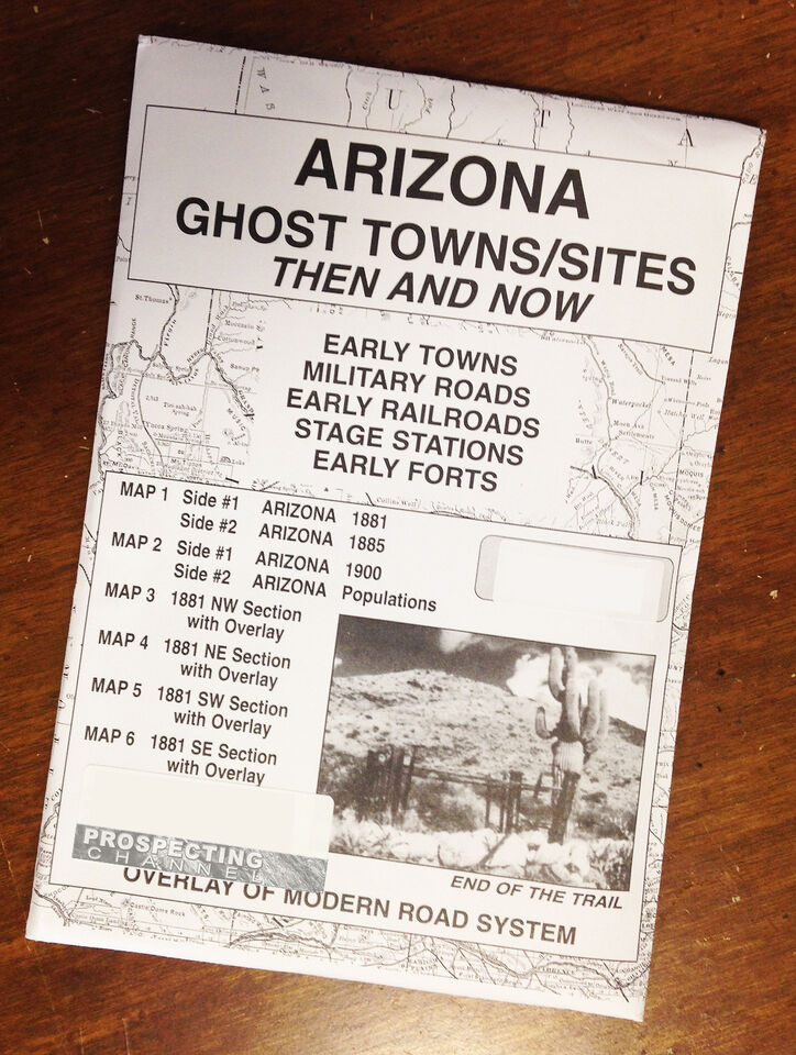
Arizona Edition State Ghost Towns and Sites Then and Now Maps
BRAND NEW IN PACKAGE
All maps combined cover entire state of Arizona.
Includes 6 Maps
MAP 1:
side #1 Arizona 1881
side #2 Arizona 1885
MAP 2:
side #1 Arizona 1900
side #2 Arizona Populations
MAP 3:
1881 NW Section with overlay
MAP 4:
1881 NE Section with overlay
MAP 5:
1881 SW Section with overlay
MAP 6:
1881 SE Section with overlay
Overlay Modern Road System over Historical Maps and find Early Towns, Military Roads, Early Railroads, and Early Forts!
Map sections when combined cover then entire state of Arizona.
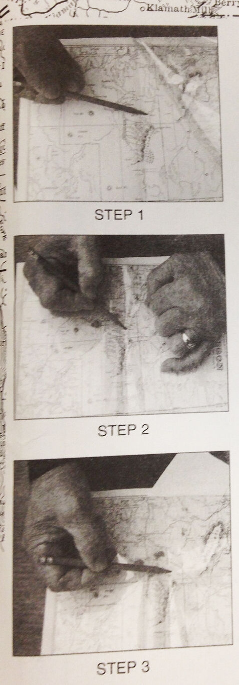
See picture 2 for an example of the maps with use of overlays
Using the Overlays:
The overlay, which is used over the map of Arizona, 1881, (maps 3,4,5 & 6) has been reproduced from a modern map. The purpose is to show the changes in the state over a period of 100 years! Place names may appear in 1881 which are absent of the current map. Some of the locations may have been early stage stations, mining camps, ranches or early town sites later abandoned.
The different locations noted in boundaries, landmarks and place names are evident.
A great historical reference guide to find these old historical areas.
BRAND NEW IN PACKAGE
All maps combined cover entire state of Arizona.
Includes 6 Maps
MAP 1:
side #1 Arizona 1881
side #2 Arizona 1885
MAP 2:
side #1 Arizona 1900
side #2 Arizona Populations
MAP 3:
1881 NW Section with overlay
MAP 4:
1881 NE Section with overlay
MAP 5:
1881 SW Section with overlay
MAP 6:
1881 SE Section with overlay
Overlay Modern Road System over Historical Maps and find Early Towns, Military Roads, Early Railroads, and Early Forts!
Map sections when combined cover then entire state of Arizona.
See picture 2 for an example of the maps with use of overlays
Using the Overlays:
The overlay, which is used over the map of Arizona, 1881, (maps 3,4,5 & 6) has been reproduced from a modern map. The purpose is to show the changes in the state over a period of 100 years! Place names may appear in 1881 which are absent of the current map. Some of the locations may have been early stage stations, mining camps, ranches or early town sites later abandoned.
The different locations noted in boundaries, landmarks and place names are evident.
A great historical reference guide to find these old historical areas.
Share
SKU:
View full details